Geocoding the past and current uses of Frenchman Bay from historic and current oral histories
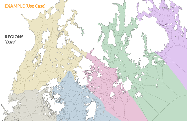 Map illustrating classification of the ocean into sea units and bays off the coast of Lincoln and Hancock County
Oral histories provide a powerful set of insights into how ecosystems and communities have responded to changing conditions and fish abundance over time. The goal of this project is to study the changes in coastal use through time and space using data science techniques to offer a bird’s eye view of coastal Maine over several generations through the Maine Historical Fisheries Atlas (MHFA).
MHFA is a shareable resource of data and maps from biographical and ecological information of fisheries past and present collected in interviews. The atlas we will develop consists of GIS layers created from spatial data mentioned in interviews including the locations of important fisheries and species, such as historical weirs, cod grounds, shrimp tows, clam and worm flats, shellfish farms and seaweed culture lines. In this project we will code and visualize spatial mentions from Frenchman Bay to understand how species distributions and commercial fisheries have changed over time. During this process we will explore:
- What information or features can we use to develop meaningful spatial units (i.e. grounds) to capture use of the coast and bay by various users?
- What needs to be considered when we characterize spatial mentions in current and historical oral history archives?
- What uses do coastal communities today see for the Maine Historical Fisheries Atlas? What questions are they interested in using it to explore? What uses are important to capture?
- How can text analysis be used to aid the spatial geocoding process?
Skills developed:
- Review papers and methodology for the use of text analysis to extract spatial data.
- Brainstorm and develop a series of questions to ask stakeholders on spatial units and their meaning.
- Contact and gather feedback from community stakeholders on our current geocoding and the spatial mention coding framework.
- Use feedback to refine and develop meaningful units for geocoding spatial uses from the coast and build this into the coding process in collaboration with Rhumbline Maps.
- Code the spatial mentions from a range of interviews.
- Explore the integration of text analysis into the spatial coding process.
- Develop an informed methodology for the geocoding project.
Data
- We will be working with and analyzing interviews from Maine Sound and Story and historical archives from the Fogler Collection at UMaine.